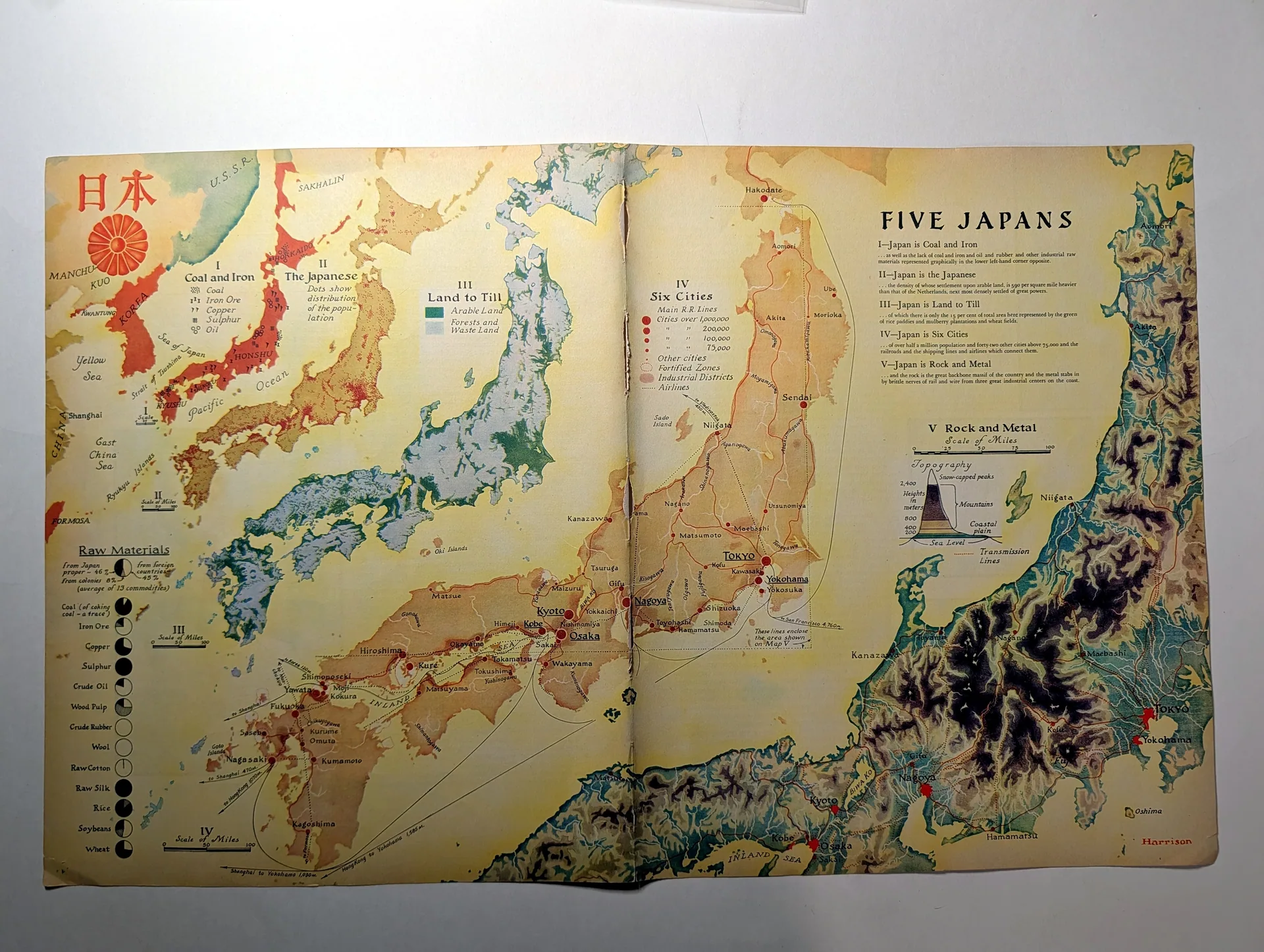
Japan — Country Map and Raw Materials Chart
This two-page map spread, titled "Five Japans," presents Japan through five thematic lenses: the Japanese proper, coal and iron, land to till, six cities, and rock and metal. A "Raw Materials" panel quantifies the sources of thirteen commodities — from Japan proper, from its colonies, and from foreign countries — with pie diagrams for coal, iron ore, copper, sulphur, crude oil, wood pulp, crude rubber, wool, raw cotton, raw silk, rice, soybeans, and wheat. The inclusion of Formosa and the colonial sourcing categories place the map in the era of Japan's empire. The cartography is signed "Harrison." The spread belongs to the American tradition of explanatory news cartography that made foreign economies legible to domestic readers through statistics rendered as images.
Category: Art & Museums
Rarity Class: B
Paper & Print Condition
Two-page map spread — a color halftone and line reproduction on periodical stock. The five thematic regions, the pie diagrams, and the small type of the commodity labels remain legible. The center fold is intact. Age-toning consistent with bound-issue storage is visible, particularly at the edges. The sheet is complete and flat.
Provenance & Rarity
Publication provenance: cartographer's signature "Harrison" on the sheet; mid-20th-century American periodical origin (exact issue unconfirmed). Chain of custody: from the collection of Ronin Naodhinsuk; photographed for The Record Institute archive. Rarity — Class B (provisional): statistical news maps of this ambition were produced in quantity, but complete two-page spreads with all five panels and the raw-materials chart intact are the collectible state.
Rarity & Condition Summary
Class B artifact in Good condition: complete spread, all five thematic maps and the thirteen-commodity chart legible, center fold sound. Its research value is as a contemporary American data-visualization of Japan's resource economy in the imperial era.