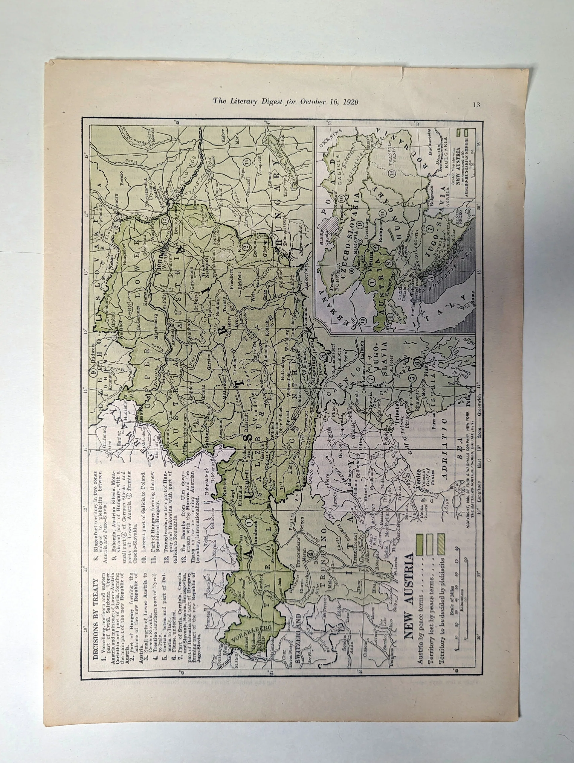
New Austria — Sketch Map, The Literary Digest, October 16, 1920
In the October 16, 1920 issue of The Literary Digest, a full-page sketch map titled "New Austria" laid out the territorial consequences of the post–World War I peace terms for American magazine readers. The map distinguishes, by shading, territory lost under the peace terms, territory retained, and districts left to plebiscite. An inset sketch map sets the shrunken republic against the outline of the former Austro-Hungarian Empire, making the scale of the empire's dissolution legible at a glance. Published two years after the armistice and in the same year the Treaty of Saint-Germain-en-Laye took effect, the map belongs to the wave of American explanatory cartography that translated the redrawn map of Europe for a mass audience. The imprint names Funk & Wagnalls Company, New York, copyright 1920.
Category: Art & Museums
Year: 1920
Rarity Class: B
Paper & Print Condition
Full-page magazine map — a halftone and line reproduction on periodical stock. The linework of the boundaries and the stippled shading remain legible; the inset map at lower left is intact. Age-toning consistent with bound-issue storage is visible at the sheet edges. The sheet is complete and flat, retained with its printed caption "The Literary Digest for October 16, 1920" at the foot.
Provenance & Rarity
Publication provenance (bibliographic): The Literary Digest, October 16, 1920; copyright 1920 by Funk & Wagnalls Company, printed on the sheet. Chain of custody: from the collection of Ronin Naodhinsuk; photographed for The Record Institute archive. Rarity — Class B (provisional): the issue was mass-circulation, but complete, flat, well-preserved map pages from bound 1920 issues are encountered less often than the magazine's text pages, which were more frequently clipped.
Rarity & Condition Summary
Class B artifact in Good condition: complete and flat, all map detail and the inset legible, caption and copyright line intact. Its research value lies in being a contemporary American visualization of the Austrian settlement, printed while the new borders were still news.